9 other products:
Garmin 62S Cameraless Gps (Discontinued)
The newly designed GPSMAP 62s handheld navigator features a tilt-compensated 3-axis compass, a barometric altimeter, and...
Porta GPS Swivel Belt Clip Garmin 010-11022-10
Keep your device within reach while on the go with this rotating belt clip. Your device fits securely in a holder that clips onto your belt.
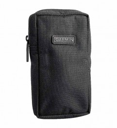
Garmin Universal GPS Carrying Case
Get durable all-round protection for your handheld device with our carrying case. Black nylon protects your device while in storage or in the field. Features a wide zippered opening and a belt loop for accessibility and portability.
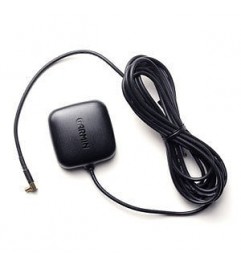
Garmin Gps Antenna 010-10702-00 Ga 25mcx Low Profile Remote
ANTENNA FOR THE GARMIN BRAND ¨AERA¨ GPS SERIES. New: A brand-new, unused, unopened, undamaged item in the original packaging (if packaged).
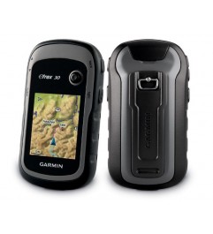
Garmin Gps Black And White Ref Etrex 30 Economic
The eTrex 30 is an upgrade from one of the most reliable and popular handheld GPS devices. Its improved ergonomics and user interface, "paperless" geocaching, and expanded mapping capabilities make the eTrex more versatile and easier to use,...
Garmin Map 64S GPS Without Camera
The new GPSMAP® 64s has a 2.6 "sunlight-readable display and a high-sensitivity GPS and GLONASS receiver with a Quadrifilar Helix antenna for superior reception capabilities. High-sensitivity GPS and GLONASS with a Quadrifilar Helix antenna for...
GPSMAP® 66s GARMIN Satellite Navigator
With the GPSMAP 66s and GPSMAP 66st devices, enjoying geocaching experiences is easier than ever. Set the device to update itself with information about the latest Geocaching Live caches, with descriptions, logs, and suggestions for the...
Product Comments


 image Featured
 Descripción
Rugged handheld with GPS / GLONASS, wireless connectivity and digital camera
• 8 megapixel camera with automatic focus and georeferencing
• High sensitivity GPS and GLONASS receiver, with quad helix antenna
• One-year subscription to BirdsEye Satellite Imagery
• Three-axis compass with barometric altimeter
• Wireless connectivity via Bluetooth®¹ or ANT + ® technology
Información Técnica
Explore the terrain
The GPSMAP 64s includes a built-in world basemap with shaded relief and a one-year subscription to BirdsEye Satellite Imagery. So you can navigate anywhere with ease. With photo browsing, you can download georeferenced images from the Internet and navigate to them.
Document your trip
Capture the highlights of your outings with the built-in 8 megapixel camera with autofocus. A georeference is automatically added to each photo with the capture location, allowing you (or your shareholders) to easily return to that location.
Orient yourself
The GPSMAP 64sc has a tilt-compensated 3-axis electronic compass that shows the direction even when you are not moving, without having to keep the device level. Its barometric altimeter records pressure changes to accurately indicate your altitude; Plus, you can plot barometric pressure over time, which can help you keep an eye on changing weather conditions
Share wirelessly
Share your waypoints, tracks, routes, and geo caches with other compatible devices wirelessly. Your friends can enjoy their favorite trail or reserve without having to connect to the computer; just press "Send" to transfer your information to another portable device fromGarmin.
GPSMAP 64sc also connects to compatible devices fromGarminincluding VIRB® action cameras, plus secondary sensors such as the tempe ™ sensor and heart rate monitor.
Stay connected
Thanks to smart notifications, you can receive emails, text messages and alerts wirelessly from your compatible smartphone. Stay connected without taking your smartphone out of your bag.
Keep your location
The GPSMAP 64sc, with its quad helix antenna and highly sensitive GPS and GLONASS receiver, not only finds your position quickly and accurately, it also preserves it even in the densest coverage and deepest valleys. The advantage is obvious, no matter if you are deep in thick woods or just near trees and tall buildings, you can count on GPSMAP 64sc to help you find your way when you need it most.
Find fun treasures
The GPSMAP 64sc supports digital geocaching with 250,000 preloaded caches, tips, and descriptions from Geocaching.com; in addition, the battery has 16 hours of autonomy. If you stop using papers, you will not only help the environment, you will also improve your efficiency. The GPSMAP 64sc stores and displays key information such as location, terrain, difficulty, tips, and descriptions. Therefore, it is no longer necessary to enter coordinates manually or print papers. The slim and lightweight 64sc is the perfect companion for all your outdoor adventures.
Plan your next tour
Take control of your next adventure with BaseCamp ™, software that lets you view and organize maps, waypoints, routes, and trails. This free trip planning software lets you even createGarminAdventures that you can share with friends, family, or fellow explorers. BaseCamp displays 2D or 3D topographic map data on your computer screen, including contour lines and elevation profiles. Also, you can transfer an unlimited number of satellite images to your device by purchasing a BirdsEye Satellite Imagery subscription.
Physical and performance characteristics | |
| UNIT DIMENSIONS (WIDTH / HEIGHT / DEPTH) | 6.1 x 16.0 x 3.6 cm (2.4 "x 6.3" x 1.4 ") |
|---|---|
| SCREEN SIZE (WIDTH / HEIGHT) | 3.6 x 5.5 cm (1.43 "x 2.15"); 6.6 cm diag (2.6 ") |
| SCREEN RESOLUTION (WIDTH / HEIGHT) | 160 x 240 pixels |
| SCREEN TYPE | transflective, 65,000 color TFT |
| WEIGHT | 230 g (8.1 oz) with batteries |
| DRUMS | Rechargeable NiMH battery pack (included) or 2 AA batteries (not included); Lithium or NiMH batteries are recommended |
| BATTERY AUTONOMY | 16 hours |
| WATER RESISTANCE CLASSIFICATION | IPX7 |
| HIGH SENSITIVITY RECEIVER | |
| INTERFACE | high speed mini USB and NMEA 0183 compatible |
| MEMORY / HISTORY | 4GB |
Maps and memory | |
| POSSIBILITY OF ADDING MAPS | |
|---|---|
| BASE MAP | |
| AUTOMATIC ROUTE CREATION (ROAD TURN BY TURN) | Yes (with optional maps with detailed road information) |
| MAP SEGMENTS | 3000 |
| BIRDSEYE | 250 BirdsEye Imagery files |
| IT INCLUDES DETAILED HYDROGRAPHIC CHARACTERISTICS (COASTALS, RIVERS OR LAKES COAST LINES, WETLANDS, PERENNIAL AND SEASONAL STREAMS). | no (additional maps are needed) |
| IT INCLUDES SEARCHES FOR POINTS OF INTEREST (PARKS, CAMPSITES, PANORAMIC VIEWPOINTS AND PÍCNIC SITES). | no (additional maps are needed) |
| SHOWS NATIONAL, STATE AND LOCAL PARKS, FORESTS AND NATURAL AREAS. | no (additional maps are needed) |
| STORAGE AND LOAD CAPACITY | microSD ™ card (not included) |
| WAYPOINTS | 5 |
| TRACKS | 200 |
| TRACK LOG | 10,000 points, 200 saved tracks |
| ROUTES | 200 |
Sensors | |
| Gps | |
|---|---|
| GLONASS | |
| BAROMETRIC ALTIMETER | |
| COMPASS | Yes (three axes with tilt compensated) |
| GPS COMPASS (WHILE MOVING) | |
Daily smart features | |
| SMART NOTIFICATIONS ON PORTABLE DEVICES | |
|---|---|
| VIRB® REMOTE CONTROL | |
| COMPATIBLE WITH GARMIN CONNECT ™ MOBILE | |
Functions for leisure and outdoor activities | |
| POINT TO POINT NAVIGATION | |
|---|---|
| COMPATIBLE WITH BASECAMP ™ | |
| CALCULATION OF AREAS | |
| HUNTING AND FISHING CALENDAR | |
| ASTRONOMIC INFORMATION | |
| GEOCACHING MODE | Yes (no paper) |
| COMPATIBLE WITH CUSTOM MAPS | Yes (500 custom map tiles) |
| PICTURES VIEWER | |
| CAMERA | yes (8 megapixels with auto focus and georeference) |
| LED BEACON FLASHLIGHT | |
Connections | |
| WIRELESS CONNECTIVITY | yes (BLUETOOTH®, ANT + ®) |
|---|---|
Additional | |
| ADDITIONAL CHARACTERISTICS | Smart notifications: yes Live tracking: yes (withGarminConnect ™ Mobile) Map Segments: 4000 Flashlight: yes |
|---|---|

 English
 Español CO


