English
 Español CO
-
-
-
-
-
Products
-
-
-
Products
-
-
-
-
Brands
-
-
-
-
-
Products
-
-
-
Doctors and Hospitals
-
Products
-
-
-
-
-
-
Aluminized Products
-
-
-
-
Confined Spaces
-
Products
-
-


Compasses

For the use of the brunton compass, the elevation difference between two points is taken into account and can be measured using the Brunton compass as a hand level. The measurement begins by placing yourself at the lowest point and locating a point on the ground that is at eye level and on a route that you can travel by walking between the two extreme points. As soon as the first observation is made, a mental note is made of any object, a branch, a leaf or a stone, which marks the observed place and a view is maintained as one walks towards the place. Placing on this mark, another point is chosen at eye level and the procedure is repeated until the final point is reached. The number of movements is counted and multiplied by the height of the observer's eye, estimating the last fraction to the nearest decimeter. When it comes to the open field, the survey can be done quickly and with precision.
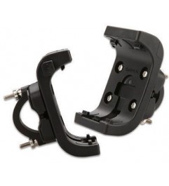
There is 1 product.
Active filters
- Brand: Garmin